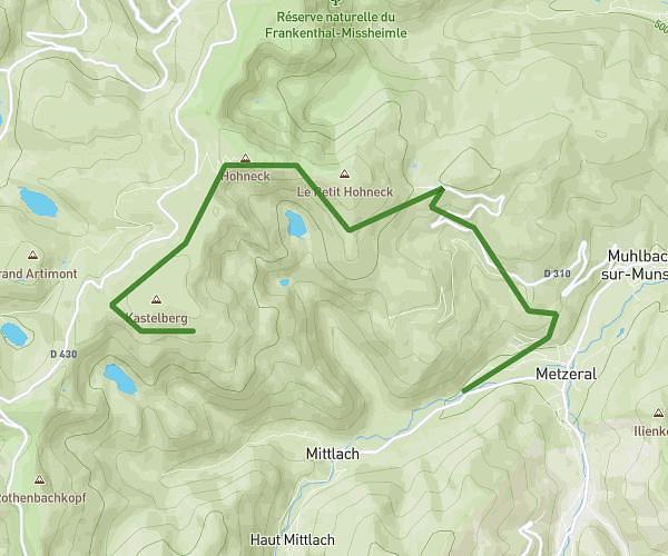
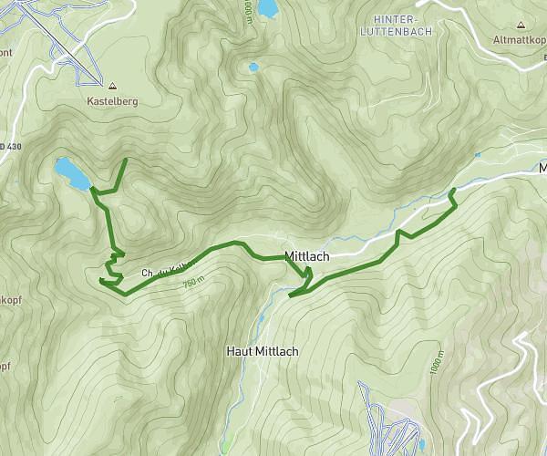
This hiking trail covers 12.232mi starting from Sainte-Marie-aux-Mines, Haut-Rhin. The hike is a loop trail and returns to the trailhead. This hike is rated as strenuous, plan for about 5h35m to complete it. The route has an elevation gain of 2854ft and an elevation loss of 2867ft.
Tour Pierre des Trois Bans
Route details
2.19mph
Speed
2518 kcal
Calories burned
8.9%
Avg grade
Loop trail
Route type
1227ft
Min altitude
3737ft
Max altitude
Steep climb
Route profile
2854ft
Elevation gain
2867ft
Elevation loss
1227ft
Min altitude
3737ft
Max altitude
How to get there
Trailhead: 3 Résidence Les Genêts, 68160 Sainte-Marie-aux-Mines, France
GPS coordinates of the trailhead: 48.246152, 7.182037 / 48°14'46'' N, 7°10'55'' E