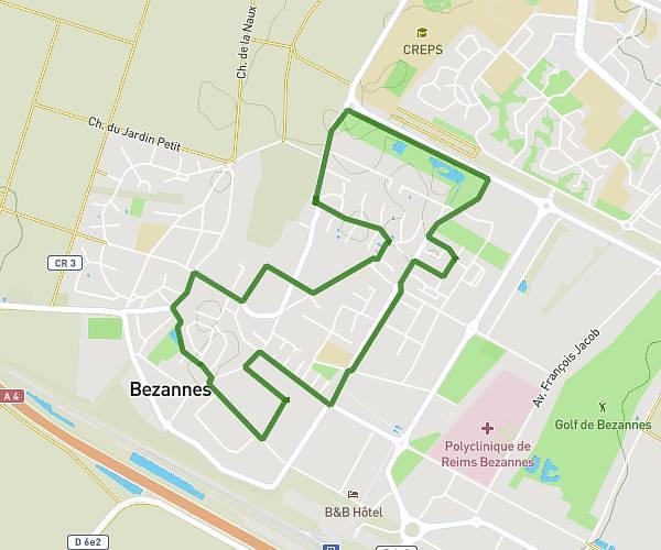
This running route covers 2.718mi starting from Reims, Marne. The run does not return to the trailhead and ends near Rue Voltaire, 51100 Reims. This run is rated as easy, expect about 26m to complete it. The route has an elevation gain of 33ft and an elevation loss of 52ft.
Dim 23 mars 2025
Route details
6.27mph
Speed
297 kcal
Calories burned
Point to point
Route type
253ft
Min altitude
302ft
Max altitude
Route profile
33ft
Elevation gain
52ft
Elevation loss
253ft
Min altitude
302ft
Max altitude
How to get there
Trailhead: Rue Saint-Symphorien, 51100 Reims
GPS coordinates of the trailhead: 49.2543, 4.03691 / 49°15'15'' N, 4°2'12'' E