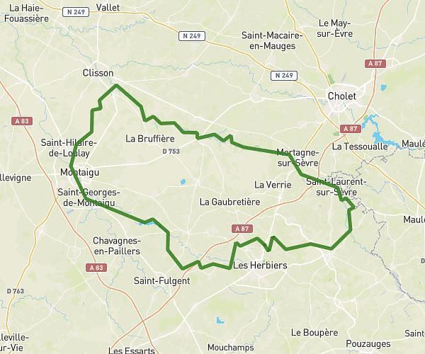
This running route covers 9.421mi starting from Montaigu-Vendée, Vendée. The run is a loop trail and returns to the trailhead. This run is rated as hard, expect about 1h41m to complete it. The route has an elevation gain of 72ft and an elevation loss of 69ft.
Sortie longue 21/02
Route details
5.6mph
Speed
1155 kcal
Calories burned
Loop trail
Route type
151ft
Min altitude
223ft
Max altitude
Route profile
72ft
Elevation gain
69ft
Elevation loss
151ft
Min altitude
223ft
Max altitude
How to get there
Trailhead: 5 Rue Du Moulin De La Roche, 85600 Montaigu-Vendée, France
GPS coordinates of the trailhead: 46.948558, -1.296744 / 46°56'54'' N, 1°17'48'' W