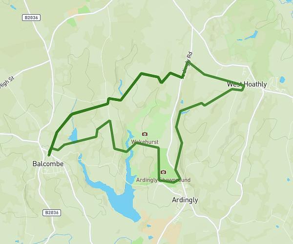
This running route covers 5.234mi starting from Haywards Heath, England. The run does not return to the trailhead and ends near Mallion's Lane, Haywards Heath, RH17 6AT, United Kingdom. This run is rated as moderate, expect about 40m to complete it. The route has an elevation gain of 151ft and an elevation loss of 161ft.
NYMANS
Route details
7.85mph
Speed
457 kcal
Calories burned
Point to point
Route type
197ft
Min altitude
358ft
Max altitude
Route profile
151ft
Elevation gain
161ft
Elevation loss
197ft
Min altitude
358ft
Max altitude
How to get there
Trailhead: Warninglid Road, Staplefield, Haywards Heath, RH17 6EU, United Kingdom
GPS coordinates of the trailhead: 51.038021, -0.183451 / 51°2'16'' N, 0°11'0'' W