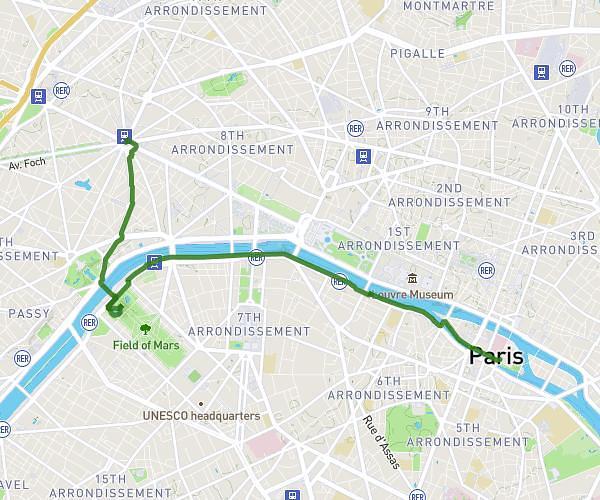
This walking route covers 0.473mi starting from Paris, Paris. The walk does not return to the trailhead and ends near Avenue Victoria, 75001 Paris. This walk is rated as easy, plan for about 11m24s to complete it. The route has an elevation gain of 121ft and an elevation loss of 141ft.
acces suger AR metro
Route details
24:08/mi
Pace
47 kcal
Calories burned
Point to point
Route type
98ft
Min altitude
161ft
Max altitude
Route profile
121ft
Elevation gain
141ft
Elevation loss
98ft
Min altitude
161ft
Max altitude
How to get there
Trailhead: Rue Suger, 75006 Paris
GPS coordinates of the trailhead: 48.85301, 2.34242 / 48°51'10'' N, 2°20'32'' E