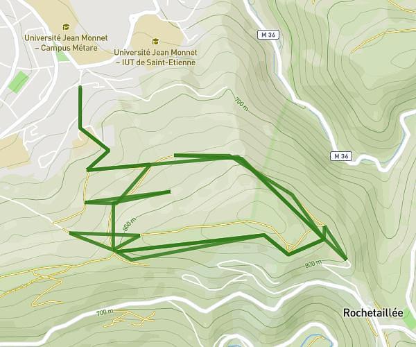
This running route covers 5.281mi starting from Chaussan, Rhône. The run is a loop trail and returns to the trailhead. This run is rated as moderate, expect about 1h14m to complete it. The route has an elevation gain of 617ft and an elevation loss of 591ft.
Saint - Saint André la Cöte 1
Route details
4.28mph
Speed
846 kcal
Calories burned
Loop trail
Route type
2028ft
Min altitude
2615ft
Max altitude
Route profile
617ft
Elevation gain
591ft
Elevation loss
2028ft
Min altitude
2615ft
Max altitude
How to get there
Trailhead: Route Du Boulard, 69440 Chaussan
GPS coordinates of the trailhead: 45.63875, 4.6148 / 45°38'19'' N, 4°36'53'' E