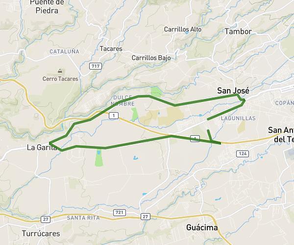
This running route covers 6.958mi starting from Alajuela, Alajuela. The run is a loop trail and returns to the trailhead. This run is rated as moderate, expect about 1h1m to complete it. The route has an elevation gain of 515ft and an elevation loss of 518ft.
11 k
Route details
6.78mph
Speed
704 kcal
Calories burned
Loop trail
Route type
2717ft
Min altitude
3054ft
Max altitude
Route profile
515ft
Elevation gain
518ft
Elevation loss
2717ft
Min altitude
3054ft
Max altitude
How to get there
Trailhead: Radial Coyol, Alajuela - Alajuela, 20102, Costa Rica
GPS coordinates of the trailhead: 10.002773, -84.253676 / 10°0'9'' N, 84°15'13'' W