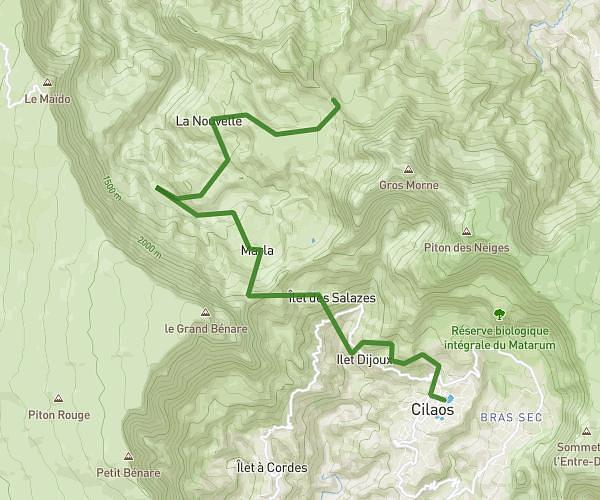
This hiking trail covers 4.226mi starting from Cilaos, Reunion. The hike is a loop trail and returns to the trailhead. This hike is rated as strenuous, plan for about 2h32m to complete it. The route has an elevation gain of 2461ft and an elevation loss of 2467ft.
Jour 2 Cilaos
Route details
1.67mph
Speed
1260 kcal
Calories burned
22.1%
Avg grade
Loop trail
Route type
2986ft
Min altitude
4029ft
Max altitude
Steep climb
Route profile
2461ft
Elevation gain
2467ft
Elevation loss
2986ft
Min altitude
4029ft
Max altitude
How to get there
Trailhead: 7 D 242, 97413, Cilaos, Reunion
GPS coordinates of the trailhead: -21.123884, 55.455945 / 21°7'25'' S, 55°27'21'' E