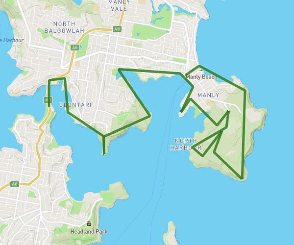
This hiking trail covers 18.606mi starting from Sydney, New South Wales. The hike does not return to the trailhead and ends near 19 Gaerloch Avenue, Tamarama New South Wales 2026, Australia. This hike is rated as hard, plan for about 5h55m to complete it. The route has an elevation gain of 1342ft and an elevation loss of 1545ft.
Wollongong Stage 1
Route details
3.14mph
Speed
2542 kcal
Calories burned
2.9%
Avg grade
Point to point
Route type
0ft
Min altitude
266ft
Max altitude
Route profile
1342ft
Elevation gain
1545ft
Elevation loss
0ft
Min altitude
266ft
Max altitude
How to get there
Trailhead: 183 Kent Street, Millers Point New South Wales 2000, Australia
GPS coordinates of the trailhead: -33.86285, 151.20374 / 33°51'46'' S, 151°12'13'' E