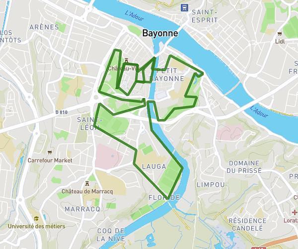
This running route covers 6.357mi starting from Bayonne, Pyrénées-Atlantiques. The run is a loop trail and returns to the trailhead. This run is rated as moderate, expect about 58m17s to complete it. The route has an elevation gain of 381ft and an elevation loss of 381ft.
Les championnes
Route details
6.54mph
Speed
666 kcal
Calories burned
Loop trail
Route type
0ft
Min altitude
75ft
Max altitude
Route profile
381ft
Elevation gain
381ft
Elevation loss
0ft
Min altitude
75ft
Max altitude
How to get there
Trailhead: 15 Rue Jules Balasque, 64100 Bayonne, France
GPS coordinates of the trailhead: 43.4979, -1.463 / 43°29'52'' N, 1°27'46'' W