MapPlanner
13.773mi
Distance
1h23m
Duration
9.95mph
Speed
+341ft
Elevation gain
-282ft
Elevation loss
Moderate
Level

David 3

Route details

731 kcal
Calories burned
0.9%
Avg grade
Loop trail
Route type
249ft
Min altitude
430ft
Max altitude

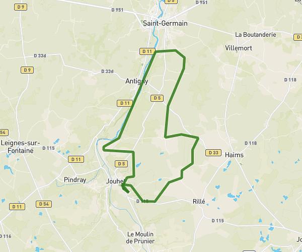
This cycling route covers 13.773mi starting from Jouhet, Vienne. The ride is a loop trail and returns to the trailhead. This route is rated as moderate, plan for about 1h23m to complete it. The route has an elevation gain of 341ft and an elevation loss of 282ft.

Route profile

341ft
Elevation gain
282ft
Elevation loss
249ft
Min altitude
430ft
Max altitude

How to get there

Trailhead: Route De Montmorillon, 86500 Jouhet

GPS coordinates of the trailhead: 46.48684, 0.8449 / 46°29'12'' N, 0°50'41'' E

Caution: May Cross Private Property

This route may pass through or near private property. Always respect posted signs, obtain permission where required, and follow local trespassing laws. MapPlanner does not guarantee public access along any route.

Safety Notice

Trail and road conditions may change without notice due to weather, construction, or other factors. Always verify current conditions before heading out. You are responsible for your own safety — follow local signage, obey traffic laws, and use your best judgment on the trail.