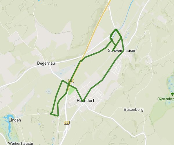
This running route covers 4.169mi starting from Hochdorf, Baden-Württemberg. The run is a loop trail and returns to the trailhead. This run is rated as easy, expect about 45m to complete it. The route has an elevation gain of 194ft and an elevation loss of 194ft.
Backyatc
Route details
5.56mph
Speed
515 kcal
Calories burned
Loop trail
Route type
1765ft
Min altitude
1814ft
Max altitude
Route profile
194ft
Elevation gain
194ft
Elevation loss
1765ft
Min altitude
1814ft
Max altitude
How to get there
Trailhead: Appendorfer Straße 9, 88454 Hochdorf, Germany
GPS coordinates of the trailhead: 48.041494, 9.796702 / 48°2'29'' N, 9°47'48'' E