MapPlanner
10.481mi
Distance
40m
Duration
15.72mph
Speed
+121ft
Elevation gain
-121ft
Elevation loss
Moderate
Level

bord de Loire

Route details

351 kcal
Calories burned
0.4%
Avg grade
Point to point
Route type
3ft
Min altitude
79ft
Max altitude

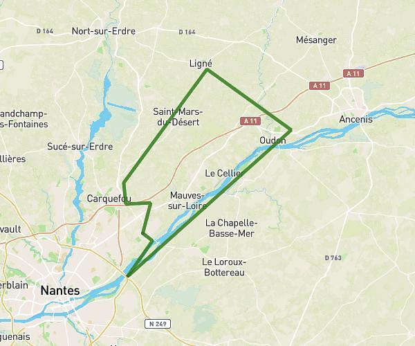
This cycling route covers 10.481mi starting from Nantes, Loire-Atlantique. The ride does not return to the trailhead and ends near 5 Chemin Du Bout Du Monde, 44470 Mauves-sur-Loire, France. This route is rated as moderate, plan for about 40m to complete it. The route has an elevation gain of 121ft and an elevation loss of 121ft.

Description of the route by the creator

very flat but windy asphalt road all the way (make the return trip) in all it's 1H20 and 32km

(Description automatically translated)

Route profile

121ft
Elevation gain
121ft
Elevation loss
3ft
Min altitude
79ft
Max altitude

How to get there

Trailhead: 7 Rue Saint-Charles, 44000 Nantes, France

GPS coordinates of the trailhead: 47.22476, -1.54333 / 47°13'29'' N, 1°32'35'' W

Caution: May Cross Private Property

This route may pass through or near private property. Always respect posted signs, obtain permission where required, and follow local trespassing laws. MapPlanner does not guarantee public access along any route.

Safety Notice

Trail and road conditions may change without notice due to weather, construction, or other factors. Always verify current conditions before heading out. You are responsible for your own safety — follow local signage, obey traffic laws, and use your best judgment on the trail.