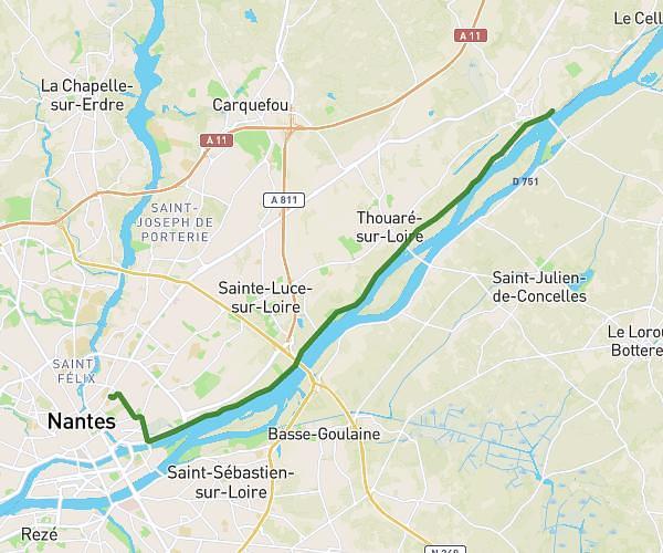
This cycling route covers 44.626mi starting from Thouaré-sur-Loire, Loire-Atlantique. The ride is a loop trail and returns to the trailhead. This route is rated as hard, plan for about 3h40m to complete it. The route has an elevation gain of 157ft and an elevation loss of 115ft.
Bord de Loire et voie verte
Route details
1927 kcal
Calories burned
0.1%
Avg grade
Loop trail
Route type
13ft
Min altitude
161ft
Max altitude
Route profile
157ft
Elevation gain
115ft
Elevation loss
13ft
Min altitude
161ft
Max altitude
How to get there
Trailhead: 3 Rue De La Frégate, 44470 Thouaré-sur-Loire, France
GPS coordinates of the trailhead: 47.26741, -1.449519 / 47°16'2'' N, 1°26'58'' W