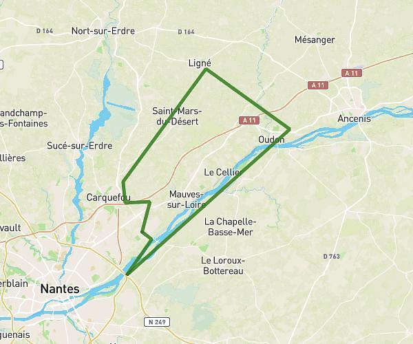
This cycling route covers 17.799mi starting from Ancenis-Saint-Géréon, Loire-Atlantique. The ride does not return to the trailhead and ends near 1 Hucheloup (Landemont), 49270 Orée d'Anjou, France. This route is rated as moderate, plan for about 2h to complete it. The route has an elevation gain of 299ft and an elevation loss of 138ft.
Biclou
Route details
1054 kcal
Calories burned
0.5%
Avg grade
Point to point
Route type
26ft
Min altitude
282ft
Max altitude
Route profile
299ft
Elevation gain
138ft
Elevation loss
26ft
Min altitude
282ft
Max altitude
How to get there
Trailhead: 359 Rue Des Sensives, 44150 Ancenis-Saint-Géréon, France
GPS coordinates of the trailhead: 47.36911, -1.1917 / 47°22'8'' N, 1°11'30'' W