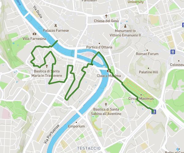
This hiking trail covers 10.735mi starting from Roma, Rome. The hike does not return to the trailhead and ends near Piazza Aruleno Celio Sabino 46, 00174 Roma Rome, Italy. This hike is rated as moderate, plan for about 6h41m to complete it. The route has an elevation gain of 482ft and an elevation loss of 377ft.
trek deii parchi
Route details
1.6mph
Speed
2852 kcal
Calories burned
1.5%
Avg grade
Point to point
Route type
72ft
Min altitude
194ft
Max altitude
Route profile
482ft
Elevation gain
377ft
Elevation loss
72ft
Min altitude
194ft
Max altitude
How to get there
Trailhead: Via Giacinto Pullino 100, 00154 Roma Rome, Italy
GPS coordinates of the trailhead: 41.865953, 12.484169 / 41°51'57'' N, 12°29'3'' E