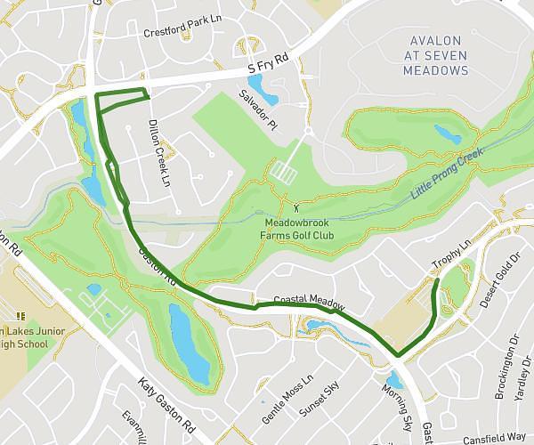
This running route covers 2.945mi starting from Pearland, Texas. The run does not return to the trailhead and ends near 4400 Barrington Way, Pearland, Texas 77584, United States. This run is rated as easy, expect about 32m2s to complete it. The route has an elevation gain of 33ft and an elevation loss of 26ft.
Canterbury Park
Route details
5.52mph
Speed
366 kcal
Calories burned
Point to point
Route type
43ft
Min altitude
59ft
Max altitude
Route profile
33ft
Elevation gain
26ft
Elevation loss
43ft
Min altitude
59ft
Max altitude
How to get there
Trailhead: 3623 Belmore Lane, Pearland, Texas 77584, United States
GPS coordinates of the trailhead: 29.537623, -95.284895 / 29°32'15'' N, 95°17'5'' W