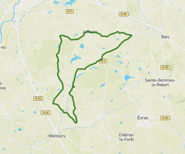
This cycling route covers 19.535mi starting from Montsûrs, Mayenne. The ride is a loop trail and returns to the trailhead. This route is rated as moderate, plan for about 1h33m to complete it. The route has an elevation gain of 187ft and an elevation loss of 187ft.
Sortie 2
Route details
816 kcal
Calories burned
0.4%
Avg grade
Loop trail
Route type
325ft
Min altitude
469ft
Max altitude
Route profile
187ft
Elevation gain
187ft
Elevation loss
325ft
Min altitude
469ft
Max altitude
How to get there
Trailhead: 29 Impasse De La Touche, 53150 Montsûrs, France
GPS coordinates of the trailhead: 48.19239, -0.52343 / 48°11'32'' N, 0°31'24'' W