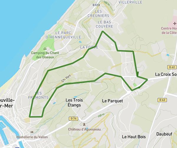
This running route covers 8.506mi starting from Honfleur, Calvados. The run is a loop trail and returns to the trailhead. This run is rated as hard, expect about 1h34m to complete it. The route has an elevation gain of 7ft and an elevation loss of 16ft.
Honfleur
Route details
5.4mph
Speed
1081 kcal
Calories burned
Loop trail
Route type
10ft
Min altitude
20ft
Max altitude
Route profile
7ft
Elevation gain
16ft
Elevation loss
10ft
Min altitude
20ft
Max altitude
How to get there
Trailhead: 351 Route De Trouville, 14600 Honfleur, France
GPS coordinates of the trailhead: 49.424034, 0.211646 / 49°25'26'' N, 0°12'41'' E