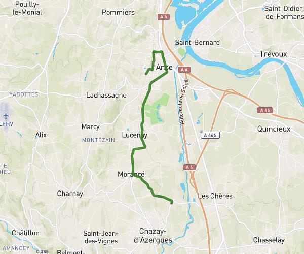
This running route covers 11.217mi starting from Dagneux, Ain. The run is a loop trail and returns to the trailhead. This run is rated as strenuous, expect about 1h48m to complete it. The route has an elevation gain of 217ft and an elevation loss of 52ft.
Circuit de la cotiere
Route details
6.23mph
Speed
1235 kcal
Calories burned
Loop trail
Route type
722ft
Min altitude
938ft
Max altitude
Route profile
217ft
Elevation gain
52ft
Elevation loss
722ft
Min altitude
938ft
Max altitude
How to get there
Trailhead: Rue Des Granges, 01120 Dagneux
GPS coordinates of the trailhead: 45.85754, 5.06877 / 45°51'27'' N, 5°4'7'' E