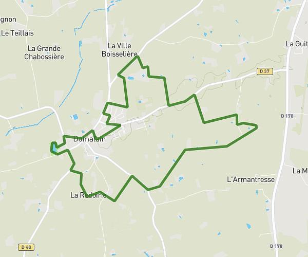
This running route covers 7.463mi starting from Bourgbarré, Ille-et-Vilaine. The run is a loop trail and returns to the trailhead. This run is rated as hard, expect about 1h12m to complete it. The route has an elevation gain of 479ft and an elevation loss of 482ft.
Défouloir
Route details
6.22mph
Speed
823 kcal
Calories burned
Loop trail
Route type
85ft
Min altitude
200ft
Max altitude
Route profile
479ft
Elevation gain
482ft
Elevation loss
85ft
Min altitude
200ft
Max altitude
How to get there
Trailhead: Allée Des Primevères, 35230 Bourgbarré
GPS coordinates of the trailhead: 47.98902, -1.61436 / 47°59'20'' N, 1°36'51'' W