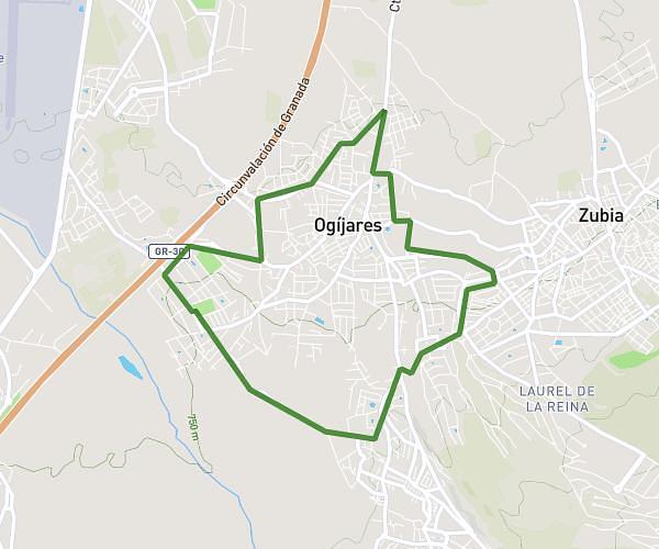
This running route covers 5.618mi starting from Ogíjares, Granada. The run is a loop trail and returns to the trailhead. This run is rated as moderate, expect about 1h16s to complete it. The route has an elevation gain of 430ft and an elevation loss of 433ft.
Gojar, La Zubia, Ogijares
Route details
5.59mph
Speed
689 kcal
Calories burned
Loop trail
Route type
2306ft
Min altitude
2618ft
Max altitude
Route profile
430ft
Elevation gain
433ft
Elevation loss
2306ft
Min altitude
2618ft
Max altitude
How to get there
Trailhead: Camino De Gabia 19, 18151 Ogíjares, Granada, Spain
GPS coordinates of the trailhead: 37.114098, -3.620025 / 37°6'50'' N, 3°37'12'' W