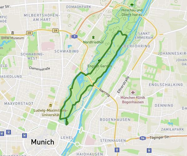
This running route covers 6.838mi starting from München, Bavaria. The run is a loop trail and returns to the trailhead. This run is rated as moderate, expect about 1h32m to complete it. The route has an elevation gain of 62ft and an elevation loss of 79ft.
Sunday022225
Route details
4.46mph
Speed
1052 kcal
Calories burned
Loop trail
Route type
1818ft
Min altitude
1896ft
Max altitude
Route profile
62ft
Elevation gain
79ft
Elevation loss
1818ft
Min altitude
1896ft
Max altitude
How to get there
Trailhead: Fürstenackerstraße 21, 81477 München, Germany
GPS coordinates of the trailhead: 48.086146, 11.517434 / 48°5'10'' N, 11°31'2'' E