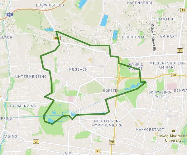
This running route covers 6.193mi starting from München, Bavaria. The run is a loop trail and returns to the trailhead. This run is rated as moderate, expect about 1h20m to complete it. The route has an elevation gain of 581ft and an elevation loss of 584ft.
TestEnglischG
Route details
4.65mph
Speed
915 kcal
Calories burned
Loop trail
Route type
1637ft
Min altitude
1713ft
Max altitude
Route profile
581ft
Elevation gain
584ft
Elevation loss
1637ft
Min altitude
1713ft
Max altitude
How to get there
Trailhead: Prinzregentenstraße 18, 80538 München, Germany
GPS coordinates of the trailhead: 48.143581, 11.587421 / 48°8'36'' N, 11°35'14'' E