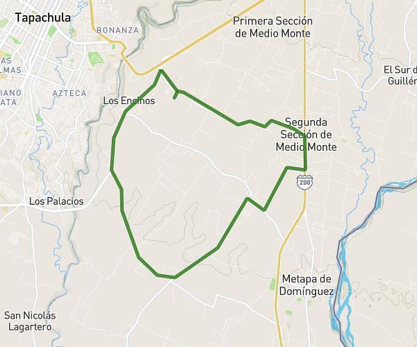
This cycling route covers 12.26mi starting from Tuxtla Chico, Chiapas. The ride does not return to the trailhead and ends near Carretera Tapachula-Talismán, 30870 Tuxtla Chico, Chiapas, Mexico. This route is rated as easy, plan for about 1h15m to complete it. The route has an elevation gain of 217ft and an elevation loss of 207ft.
Vuelta ciclista vespertina
Route details
659 kcal
Calories burned
0.7%
Avg grade
Point to point
Route type
335ft
Min altitude
538ft
Max altitude
Route profile
217ft
Elevation gain
207ft
Elevation loss
335ft
Min altitude
538ft
Max altitude
How to get there
Trailhead: Carretera Tapachula-Talismán, 30870 Tuxtla Chico, Chiapas, Mexico
GPS coordinates of the trailhead: 14.8838, -92.2263 / 14°53'1'' N, 92°13'34'' W