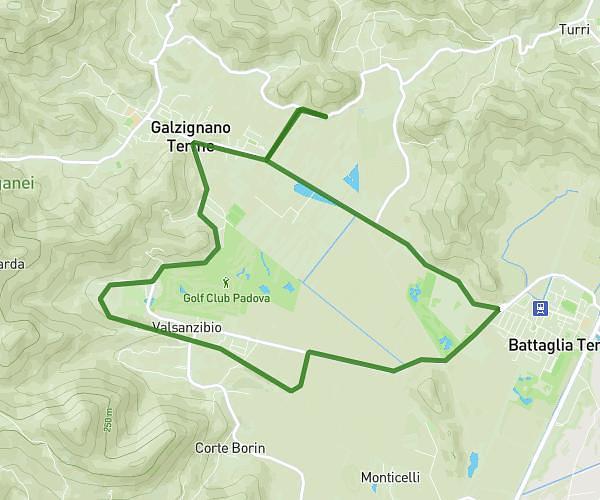
This hiking trail covers 9.66mi starting from Galzignano Terme, Padua. The hike is a loop trail and returns to the trailhead. This hike is rated as moderate, plan for about 2h35m to complete it. The route has an elevation gain of 591ft and an elevation loss of 597ft.
camminata 15km
Route details
3.73mph
Speed
1109 kcal
Calories burned
2.3%
Avg grade
Loop trail
Route type
-3ft
Min altitude
223ft
Max altitude
Route profile
591ft
Elevation gain
597ft
Elevation loss
-3ft
Min altitude
223ft
Max altitude
How to get there
Trailhead: Via Regazzoni, 35030 Galzignano Terme
GPS coordinates of the trailhead: 45.30862, 11.75143 / 45°18'31'' N, 11°45'5'' E