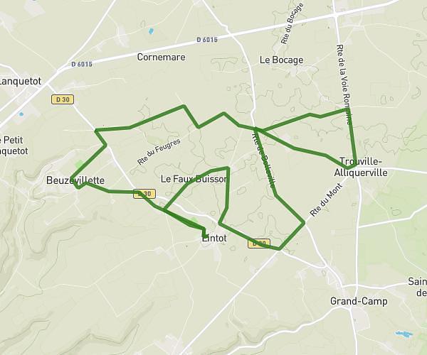
This running route covers 7.673mi starting from Flamanville, Seine-Maritime. The run is a loop trail and returns to the trailhead. This run is rated as hard, expect about 1h22m to complete it. The route has an elevation gain of 325ft and an elevation loss of 325ft.
12km
Route details
5.62mph
Speed
938 kcal
Calories burned
Loop trail
Route type
453ft
Min altitude
545ft
Max altitude
Route profile
325ft
Elevation gain
325ft
Elevation loss
453ft
Min altitude
545ft
Max altitude
How to get there
Trailhead: 15 Rue Du Château, 76970 Flamanville, France
GPS coordinates of the trailhead: 49.634749, 0.828963 / 49°38'5'' N, 0°49'44'' E