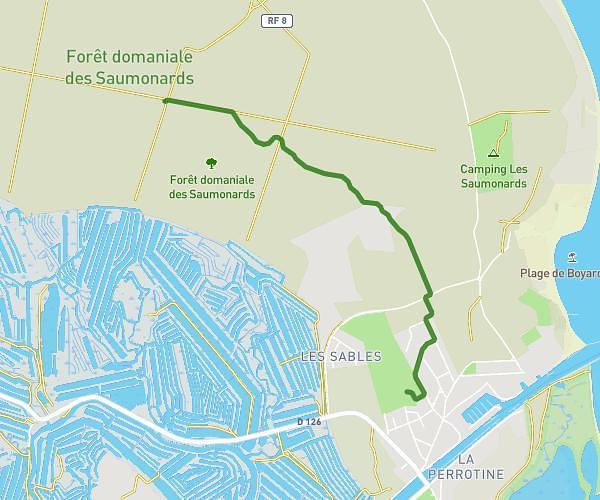
This running route covers 2.981mi starting from La Rochelle, Charente-Maritime. The run does not return to the trailhead and ends near 44 Quai Duperré, 17000 La Rochelle, France. This run is rated as easy, expect about 32m to complete it. The route has an elevation gain of 13ft and an elevation loss of 7ft.
5k LR
Route details
5.59mph
Speed
366 kcal
Calories burned
Point to point
Route type
10ft
Min altitude
20ft
Max altitude
Route profile
13ft
Elevation gain
7ft
Elevation loss
10ft
Min altitude
20ft
Max altitude
How to get there
Trailhead: 3 Rue De L'armide, 17000 La Rochelle, France
GPS coordinates of the trailhead: 46.15583, -1.15243 / 46°9'20'' N, 1°9'8'' W