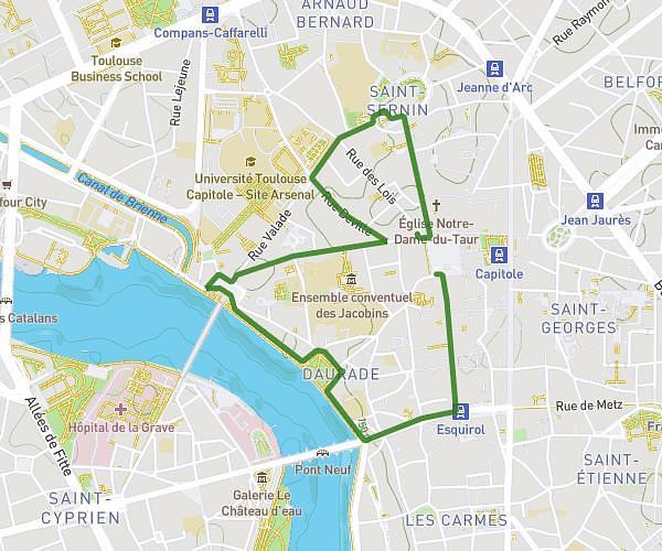
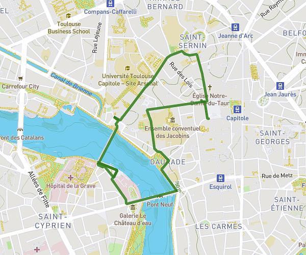
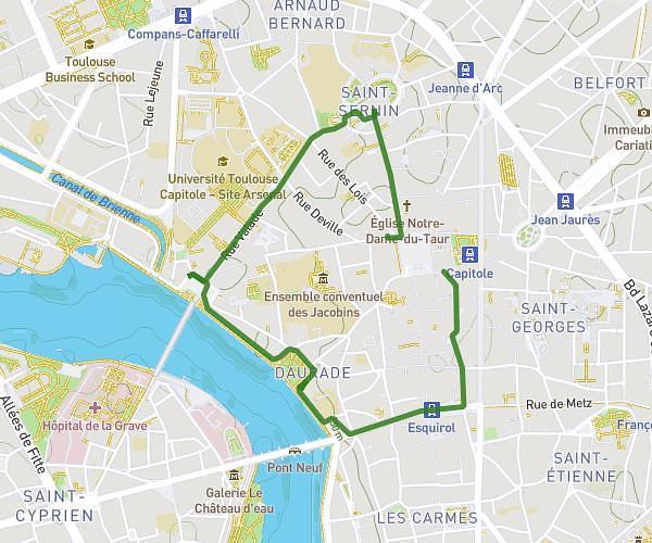
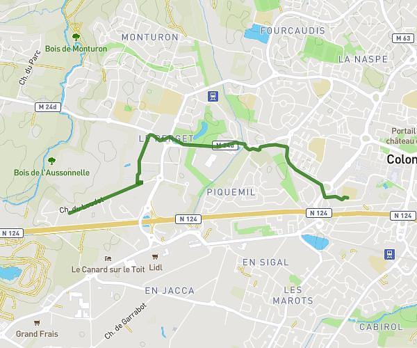
This walking route covers 4.08mi starting from L'Isle-Jourdain, Gers. The walk is a loop trail and returns to the trailhead. This walk is rated as moderate, plan for about 40m to complete it. The route has an elevation gain of 295ft and an elevation loss of 295ft.
SUPER U 2025
Route details
9:48/mi
Pace
163 kcal
Calories burned
Loop trail
Route type
499ft
Min altitude
584ft
Max altitude
Route profile
295ft
Elevation gain
295ft
Elevation loss
499ft
Min altitude
584ft
Max altitude
How to get there
Trailhead: 1 Rue Kléber, 32600 L'Isle-Jourdain, France
GPS coordinates of the trailhead: 43.61426, 1.08421 / 43°36'51'' N, 1°5'3'' E