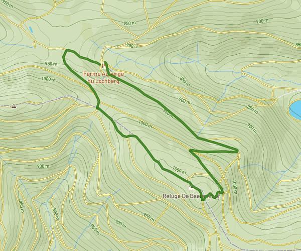
This hiking trail covers 13.811mi starting from Storckensohn, Vosges. The hike is a loop trail and returns to the trailhead. This hike is rated as strenuous, plan for about 6h40m to complete it. The route has an elevation gain of 5322ft and an elevation loss of 5295ft.
Rouge Gazon - Ballon d'Alsace et retour
Route details
2.07mph
Speed
3141 kcal
Calories burned
14.6%
Avg grade
Loop trail
Route type
2011ft
Min altitude
4045ft
Max altitude
Steep climb
Route profile
5322ft
Elevation gain
5295ft
Elevation loss
2011ft
Min altitude
4045ft
Max altitude
How to get there
Trailhead: 14 Route De Rouge Gazon, 88560 Storckensohn, France
GPS coordinates of the trailhead: 47.854631, 6.918009 / 47°51'16'' N, 6°55'4'' E