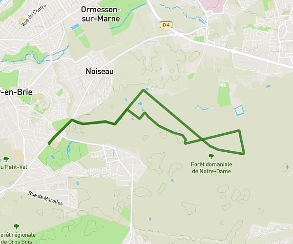
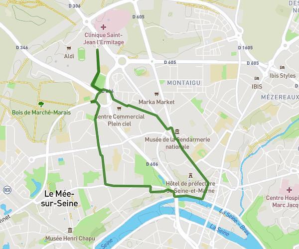
This walking route covers 4.386mi starting from Le Mée-sur-Seine, Seine-et-Marne. The walk does not return to the trailhead and ends near 47 Avenue Maurice Dauvergne, 77350 Le Mée-sur-Seine, France. This walk is rated as moderate, plan for about 1h45m to complete it. The route has an elevation gain of 230ft and an elevation loss of 226ft.
Le Mee sur Seine plein ☀️
Route details
24:08/mi
Pace
432 kcal
Calories burned
Point to point
Route type
226ft
Min altitude
272ft
Max altitude
Route profile
230ft
Elevation gain
226ft
Elevation loss
226ft
Min altitude
272ft
Max altitude
How to get there
Trailhead: 290 Avenue Maurice Dauvergne, 77350 Le Mée-sur-Seine, France
GPS coordinates of the trailhead: 48.543826, 2.640385 / 48°32'37'' N, 2°38'25'' E