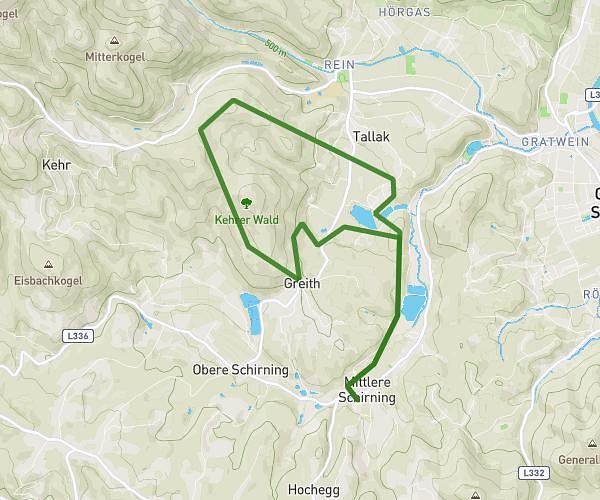
This running route covers 8.706mi starting from Gratwein-Straßengel, Styria. The run is a loop trail and returns to the trailhead. This run is rated as hard, expect about 3h to complete it. The route has an elevation gain of 545ft and an elevation loss of 607ft.
Reiten
Route details
2.9mph
Speed
2058 kcal
Calories burned
Loop trail
Route type
1296ft
Min altitude
1903ft
Max altitude
Route profile
545ft
Elevation gain
607ft
Elevation loss
1296ft
Min altitude
1903ft
Max altitude
How to get there
Trailhead: Teichhütterweg, 8112 Gratwein-Straßengel, Austria
GPS coordinates of the trailhead: 47.10439, 15.28985 / 47°6'15'' N, 15°17'23'' E