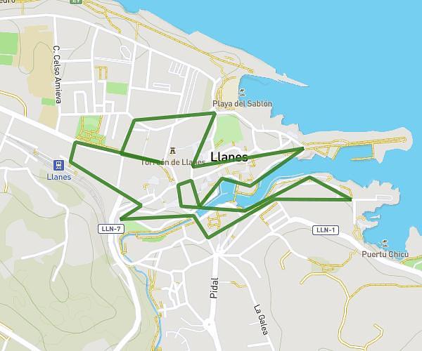
This running route covers 2.247mi starting from Llanes, Asturias. The run is a loop trail and returns to the trailhead. This run is rated as easy, expect about 24m to complete it. The route has an elevation gain of 30ft and an elevation loss of 20ft.
SAN SILVESTRE 2025
Route details
5.62mph
Speed
274 kcal
Calories burned
Loop trail
Route type
23ft
Min altitude
52ft
Max altitude
Route profile
30ft
Elevation gain
20ft
Elevation loss
23ft
Min altitude
52ft
Max altitude
How to get there
Trailhead: Calle Nemesio Sobrino 2d, 33500 Llanes, Asturias, Spain
GPS coordinates of the trailhead: 43.421002, -4.755589 / 43°25'15'' N, 4°45'20'' W