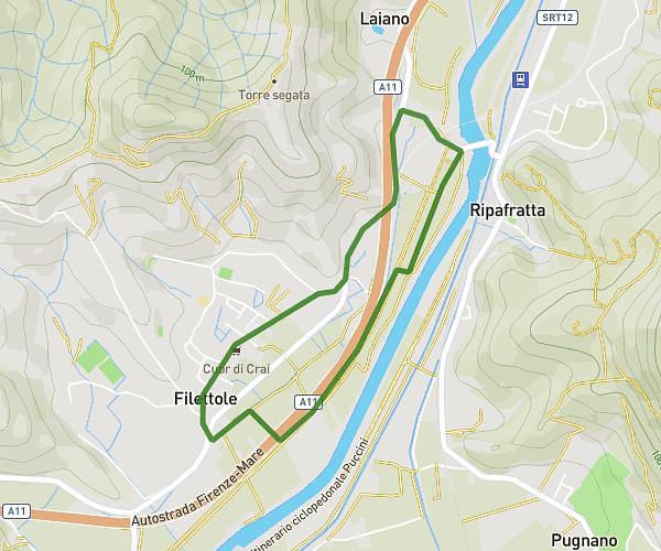
This running route covers 2.866mi starting from Pisa, Pisa. The run is a loop trail and returns to the trailhead. This run is rated as easy, expect about 20m to complete it. The route has an elevation gain of 187ft and an elevation loss of 187ft.
2025/10/10 cross fine allenamento
Route details
8.6mph
Speed
229 kcal
Calories burned
Loop trail
Route type
3ft
Min altitude
46ft
Max altitude
Route profile
187ft
Elevation gain
187ft
Elevation loss
3ft
Min altitude
46ft
Max altitude
How to get there
Trailhead: Via Atleti Azzurri Pisani, 56122 Pisa Pisa, Italy
GPS coordinates of the trailhead: 43.71734, 10.38453 / 43°43'2'' N, 10°23'4'' E