MapPlanner
12.512mi
Distance
1h49m
Duration
8:47/mi
Pace
Strenuous
Level

Course à ^pied

Route details

6.84mph
Speed
1256 kcal
Calories burned
Loop trail
Route type
141ft
Min altitude
295ft
Max altitude

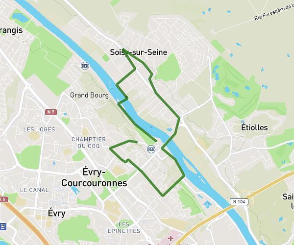
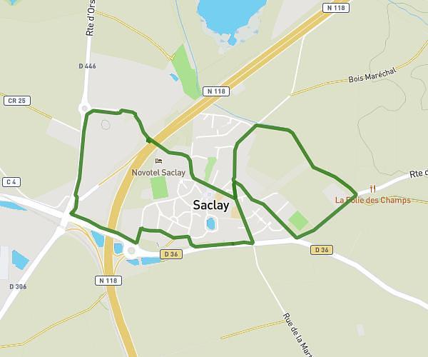
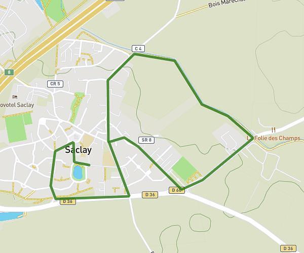
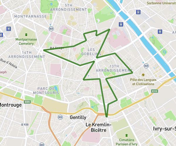
This running route covers 12.512mi starting from Le Coudray-Montceaux, Essonne. The run is a loop trail and returns to the trailhead. This run is rated as strenuous, expect about 1h49m to complete it. The route has an elevation gain of 167ft and an elevation loss of 138ft.

Description of the route by the creator

20 km

(Description automatically translated)

Route profile

167ft
Elevation gain
138ft
Elevation loss
141ft
Min altitude
295ft
Max altitude

How to get there

Trailhead: Allée Du Bois Carré, 91830 Le Coudray-Montceaux

GPS coordinates of the trailhead: 48.5611, 2.48924 / 48°33'39'' N, 2°29'21'' E

Caution: May Cross Private Property

This route may pass through or near private property. Always respect posted signs, obtain permission where required, and follow local trespassing laws. MapPlanner does not guarantee public access along any route.

Safety Notice

Trail and road conditions may change without notice due to weather, construction, or other factors. Always verify current conditions before heading out. You are responsible for your own safety — follow local signage, obey traffic laws, and use your best judgment on the trail.