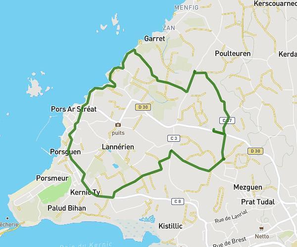
This running route covers 4.018mi starting from Pleyber-Christ, Finistère. The run is a loop trail and returns to the trailhead. This run is rated as easy, expect about 2h56s to complete it. The route has an elevation gain of 203ft and an elevation loss of 207ft.
Long
Route details
1.99mph
Speed
1383 kcal
Calories burned
Loop trail
Route type
236ft
Min altitude
443ft
Max altitude
Route profile
203ft
Elevation gain
207ft
Elevation loss
236ft
Min altitude
443ft
Max altitude
How to get there
Trailhead: 17 Route De Saint-Thégonnec, 29410 Pleyber-Christ, France
GPS coordinates of the trailhead: 48.50938, -3.88975 / 48°30'33'' N, 3°53'23'' W