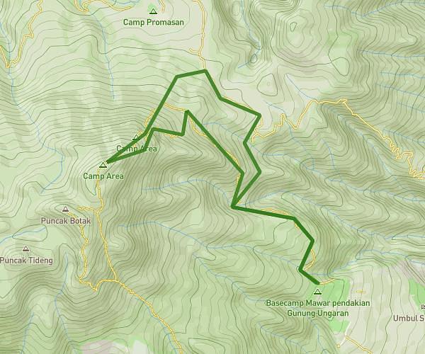
This hiking trail covers 7.732mi starting from Magelang, Central Java. The hike is a loop trail and returns to the trailhead. This hike is rated as hard, plan for about 1h22m to complete it. The route has an elevation gain of 6148ft and an elevation loss of 6152ft.
Andong Trail route
Route details
5.59mph
Speed
726 kcal
Calories burned
30.1%
Avg grade
Loop trail
Route type
3087ft
Min altitude
5640ft
Max altitude
Steep climb
Route profile
6148ft
Elevation gain
6152ft
Elevation loss
3087ft
Min altitude
5640ft
Max altitude
How to get there
Trailhead: Girirejo, 56194, Ngablak, Magelang, Central Java, Indonesia
GPS coordinates of the trailhead: -7.386692, 110.381738 / 7°23'12'' S, 110°22'54'' E