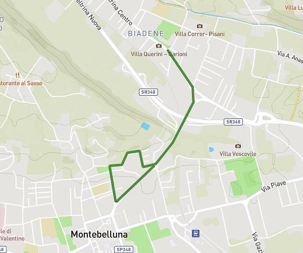
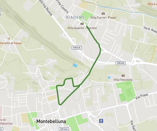
This running route covers 1.877mi starting from Montebelluna, Treviso. The run is a loop trail and returns to the trailhead. This run is rated as easy, expect about 22m39s to complete it. The route has an elevation gain of 121ft and an elevation loss of 131ft.
Circuito scuole medie con giro di lancio
Route details
4.97mph
Speed
259 kcal
Calories burned
Loop trail
Route type
417ft
Min altitude
453ft
Max altitude
Route profile
121ft
Elevation gain
131ft
Elevation loss
417ft
Min altitude
453ft
Max altitude
How to get there
Trailhead: Stradone Del Bosco, 31044 Montebelluna Treviso, Italy
GPS coordinates of the trailhead: 45.790086, 12.053014 / 45°47'24'' N, 12°3'10'' E