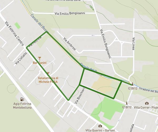
This running route covers 1.255mi starting from Montebelluna, Treviso. The run does not return to the trailhead and ends near Via Belvedere 2, 31044 Montebelluna Treviso, Italy. This run is rated as easy, expect about 11m to complete it. The route has an elevation gain of 135ft and an elevation loss of 151ft.
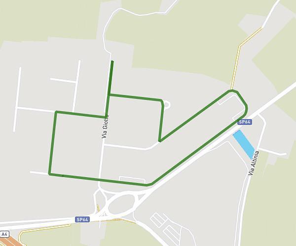
1km lancio più percorso 1km da ripetere
Route details
6.84mph
Speed
126 kcal
Calories burned
Point to point
Route type
377ft
Min altitude
456ft
Max altitude
Route profile
135ft
Elevation gain
151ft
Elevation loss
377ft
Min altitude
456ft
Max altitude
How to get there
Trailhead: Via Feltrina Centro 32, 31044 Montebelluna Treviso, Italy
GPS coordinates of the trailhead: 45.787584, 12.051371 / 45°47'15'' N, 12°3'4'' E