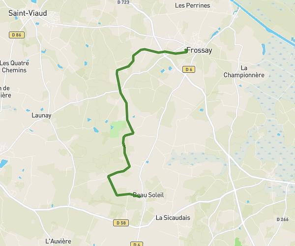
This running route covers 5.385mi starting from Saint-Père-en-Retz, Loire-Atlantique. The run does not return to the trailhead and ends near 27 Avenue Des Maillardières, 44250 Saint-Brevin-les-Pins, France. This run is rated as moderate, expect about 57m46s to complete it. The route has an elevation gain of 7ft and an elevation loss of 26ft.
apagnan
Route details
5.59mph
Speed
660 kcal
Calories burned
Point to point
Route type
30ft
Min altitude
49ft
Max altitude
Route profile
7ft
Elevation gain
26ft
Elevation loss
30ft
Min altitude
49ft
Max altitude
How to get there
Trailhead: 64 Rue De La Gare, 44320 Saint-Père-en-Retz, France
GPS coordinates of the trailhead: 47.207043, -2.042493 / 47°12'25'' N, 2°2'32'' W