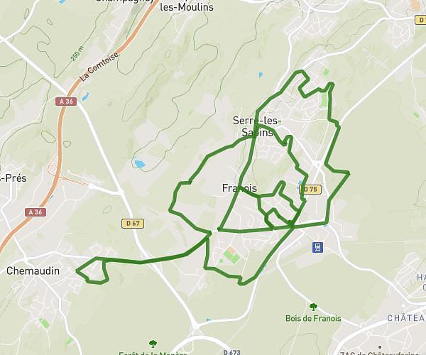
This cycling route covers 9.334mi starting from Franois, Doubs. The ride is a loop trail and returns to the trailhead. This route is rated as moderate, plan for about 56m to complete it. The route has an elevation gain of 554ft and an elevation loss of 574ft.
bernard
Route details
497 kcal
Calories burned
2.3%
Avg grade
Loop trail
Route type
866ft
Min altitude
1010ft
Max altitude
Route profile
554ft
Elevation gain
574ft
Elevation loss
866ft
Min altitude
1010ft
Max altitude
How to get there
Trailhead: 15b Rue De La Gavotte, 25770 Franois, France
GPS coordinates of the trailhead: 47.23096, 5.93111 / 47°13'51'' N, 5°55'51'' E