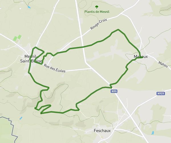
This hiking trail covers 4.563mi starting from Beauraing, Namur. The hike is a loop trail and returns to the trailhead. This hike is rated as moderate, plan for about 1h40m to complete it. The route has an elevation gain of 633ft and an elevation loss of 679ft.
tour des castels
Route details
2.74mph
Speed
731 kcal
Calories burned
5.4%
Avg grade
Loop trail
Route type
646ft
Min altitude
971ft
Max altitude
Route profile
633ft
Elevation gain
679ft
Elevation loss
646ft
Min altitude
971ft
Max altitude
How to get there
Trailhead: Rue Du Chapy, 5570 Beauraing
GPS coordinates of the trailhead: 50.09198, 4.96165 / 50°5'31'' N, 4°57'41'' E