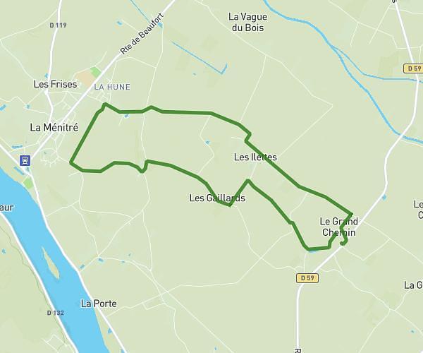
This running route covers 5.599mi starting from Louresse-Rochemenier, Maine-et-Loire. The run is a loop trail and returns to the trailhead. This run is rated as moderate, expect about 1h to complete it. The route has an elevation gain of 56ft and an elevation loss of 46ft.
Test
Route details
5.6mph
Speed
686 kcal
Calories burned
Loop trail
Route type
197ft
Min altitude
253ft
Max altitude
Route profile
56ft
Elevation gain
46ft
Elevation loss
197ft
Min altitude
253ft
Max altitude
How to get there
Trailhead: 5 Place Du Cèdre, 49700 Louresse-Rochemenier, France
GPS coordinates of the trailhead: 47.237435, -0.312754 / 47°14'14'' N, 0°18'45'' W