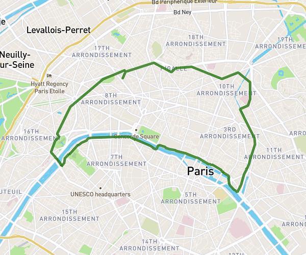
This running route covers 6.219mi starting from Île-de-France, Paris. The run does not return to the trailhead and ends near 23 Avenue Du Parc Des Princes, 75016 Paris, France. This run is rated as moderate, expect about 1h7m to complete it. The route has an elevation gain of 354ft and an elevation loss of 367ft.
We Run Paris - 2026
Route details
5.57mph
Speed
766 kcal
Calories burned
Point to point
Route type
118ft
Min altitude
197ft
Max altitude
Route profile
354ft
Elevation gain
367ft
Elevation loss
118ft
Min altitude
197ft
Max altitude
How to get there
Trailhead: 43 Boulevard Murat, 75016 Paris, France
GPS coordinates of the trailhead: 48.844193, 2.256968 / 48°50'39'' N, 2°15'25'' E