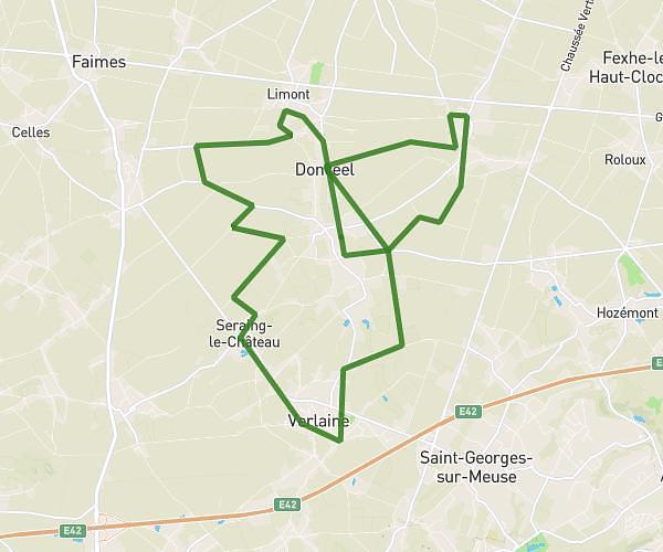
This running route covers 6.607mi starting from Sint-Truiden, Limburg. The run is a loop trail and returns to the trailhead. This run is rated as moderate, expect about 1h to complete it. The route has an elevation gain of 79ft and an elevation loss of 82ft.
A10
Route details
6.61mph
Speed
686 kcal
Calories burned
Loop trail
Route type
240ft
Min altitude
285ft
Max altitude
Route profile
79ft
Elevation gain
82ft
Elevation loss
240ft
Min altitude
285ft
Max altitude
How to get there
Trailhead: Luikersteenweg 446, 3800 Sint-Truiden, Limburg, Belgium
GPS coordinates of the trailhead: 50.78132, 5.23625 / 50°46'52'' N, 5°14'10'' E