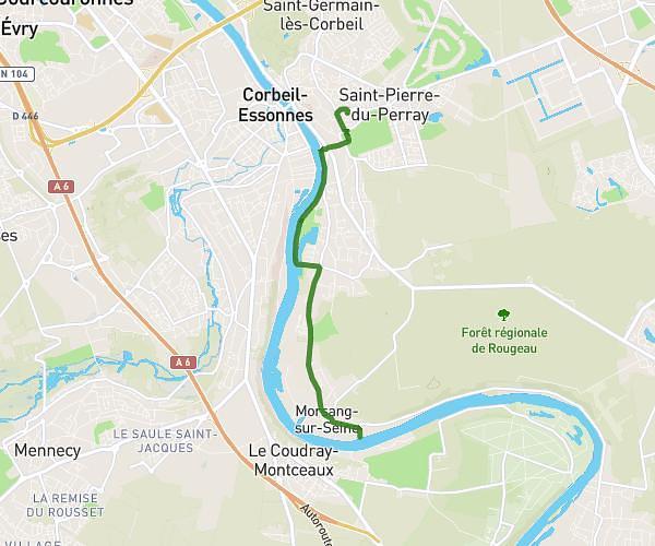
This running route covers 4.331mi starting from Chartrettes, Seine-et-Marne. The run does not return to the trailhead and ends near 91 Rue Foch, 77590 Chartrettes, France. This run is rated as easy, expect about 50m to complete it. The route has an elevation gain of 7ft and an elevation loss of 20ft.
22 juin 2025
Route details
5.19mph
Speed
572 kcal
Calories burned
Point to point
Route type
131ft
Min altitude
151ft
Max altitude
Route profile
7ft
Elevation gain
20ft
Elevation loss
131ft
Min altitude
151ft
Max altitude
How to get there
Trailhead: 5 Quai Des Vallées, 77590 Chartrettes, France
GPS coordinates of the trailhead: 48.4872, 2.72931 / 48°29'13'' N, 2°43'45'' E