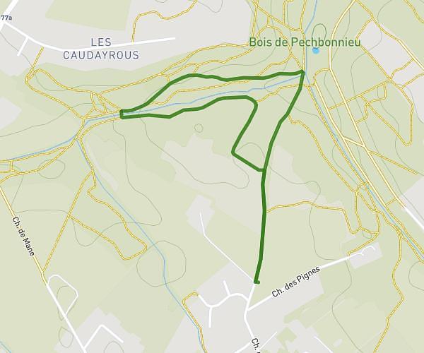
This walking route covers 4.161mi starting from La Magdelaine-sur-Tarn, Haute-Garonne. The walk does not return to the trailhead and ends near 75 Chemin De La Martigne, 31340 La Magdelaine-sur-Tarn, France. This walk is rated as easy, plan for about 1h15m to complete it. The route has an elevation gain of 177ft and an elevation loss of 174ft.
21 mars 2026
Route details
18:13/mi
Pace
310 kcal
Calories burned
Point to point
Route type
371ft
Min altitude
413ft
Max altitude
Route profile
177ft
Elevation gain
174ft
Elevation loss
371ft
Min altitude
413ft
Max altitude
How to get there
Trailhead: 1225 Route Des Vins, 31340 La Magdelaine-sur-Tarn, France
GPS coordinates of the trailhead: 43.81713, 1.522579 / 43°49'1'' N, 1°31'21'' E