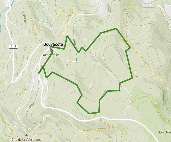
This hiking trail covers 3.087mi starting from Orbey, Haut-Rhin. The hike is a loop trail and returns to the trailhead. This hike is rated as hard, plan for about 1h5m to complete it. The route has an elevation gain of 925ft and an elevation loss of 928ft.
Pierre tremblante
Route details
2.85mph
Speed
499 kcal
Calories burned
11.4%
Avg grade
Loop trail
Route type
2221ft
Min altitude
3091ft
Max altitude
Steep climb
Route profile
925ft
Elevation gain
928ft
Elevation loss
2221ft
Min altitude
3091ft
Max altitude
How to get there
Trailhead: Chemin De Mossure, 68370 Orbey
GPS coordinates of the trailhead: 48.09759, 7.13738 / 48°5'51'' N, 7°8'14'' E