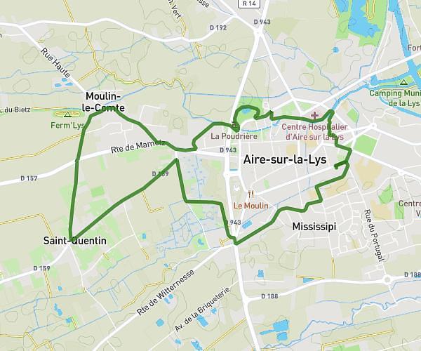
This running route covers 2.702mi starting from Saint-Venant, Pas-de-Calais. The run is a loop trail and returns to the trailhead. This run is rated as easy, expect about 30m to complete it. The route has an elevation gain of 16ft and an elevation loss of 13ft.
Saint Venant
Route details
5.41mph
Speed
343 kcal
Calories burned
Loop trail
Route type
49ft
Min altitude
59ft
Max altitude
Route profile
16ft
Elevation gain
13ft
Elevation loss
49ft
Min altitude
59ft
Max altitude
How to get there
Trailhead: 730 Allée Charles Foucault, 62350 Saint-Venant, France
GPS coordinates of the trailhead: 50.618015, 2.532229 / 50°37'4'' N, 2°31'56'' E