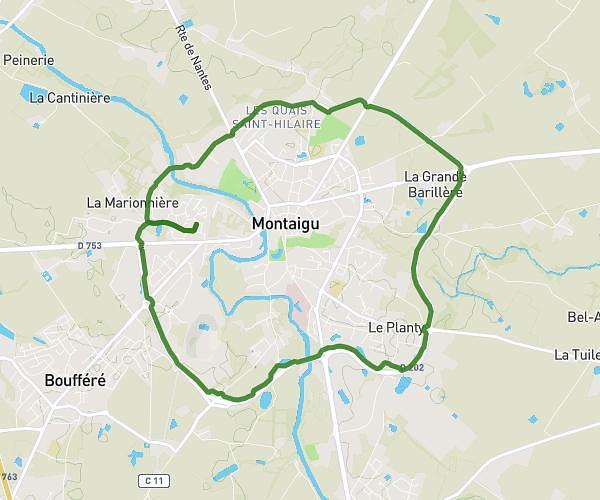
This hiking trail covers 2.755mi starting from Montaigu-Vendée, Vendée. The hike is a loop trail and returns to the trailhead. This hike is rated as easy, plan for about 57m to complete it. The route has an elevation gain of 141ft and an elevation loss of 141ft.
Parcours poussette
Route details
2.9mph
Speed
405 kcal
Calories burned
1.9%
Avg grade
Loop trail
Route type
115ft
Min altitude
161ft
Max altitude
Route profile
141ft
Elevation gain
141ft
Elevation loss
115ft
Min altitude
161ft
Max altitude
How to get there
Trailhead: 47 Rue De Nantes, 85600 Montaigu-Vendée, France
GPS coordinates of the trailhead: 47.007685, -1.337777 / 47°0'27'' N, 1°20'15'' W